Offshore wind foundation scour: compute it before you send the survey vessel
If you operate an offshore wind farm, the widest first look before sending a survey vessel is to compute offshore wind foundation scour from ocean data.
To know how much seabed has been lost around a foundation, operators usually send a vessel with a multibeam echosounder (MBES) or put a remotely operated vehicle (ROV) in the water. Both are accurate, but they need a ship, equipment and crew at the same time, so they are expensive and cannot cover the whole farm often.
The sea does not wait for the survey calendar. Scour deepens fastest when waves and currents are strong together, after storms and during spring tides, and operators often learn about it only at the next routine survey. In a farm with dozens of foundations, even choosing which one to look at first is hard.
Below we explain how scour forms, how it can be estimated from public ocean data, the limits of that estimate and how to calibrate it, and how TIDEWATCH turns it into a survey ranking. If you are deciding where your next subsea survey should start, take a look.
Category: Scour & foundations
Offshore wind foundation scour is the seabed eroding as flow wraps around a foundation
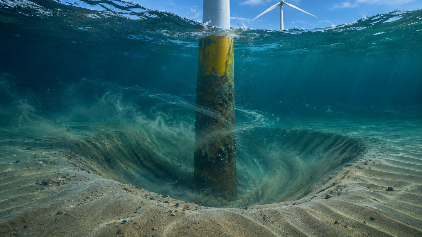
When currents or waves meet a foundation, the flow is squeezed around its sides and speeds up. A horseshoe vortex forms on the seabed in front of it and shed vortices trail behind. Together they lift sand off the bed and leave a funnel-shaped hole around the structure. That hole is scour.
As scour deepens, the soil that supports the foundation laterally shrinks. A less stiff structure changes its natural frequency and its fatigue life under millions of load cycles. That is why designers set a scour allowance and, where needed, place scour protection such as rock armour.
Scour depth and rate depend on foundation diameter, water depth, current speed, waves and grain size. Coastal engineering has studied these relations for decades, and a standard reference is Sumer and Fredsøe, The Mechanics of Scour in the Marine Environment (2002). A large monopile and a jacket with several slender members also scour in different patterns.
Estimating foundation scour from ocean data
Collect a year of hourly waves, currents and tide.
Compute the combined push of waves and currents on the seabed.
Compare it with the threshold of sediment motion.
Estimate scour depth from diameter and flow conditions.
Bed shear and the Shields number tell when sand starts to move
Sand moves when the force of the flow on the bed, the bed shear stress, exceeds what holds the grains in place. The ratio of the two is the Shields number, and the value at which motion begins is the critical Shields number. Finer sand moves under weaker flow.
At sea, currents and waves act together, and their combined bed shear can exceed the sum of the parts. A widely used method for that combination is Soulsby (1997). TIDEWATCH uses it with the Soulsby–Whitehouse threshold to decide, hour by hour, whether sand is moving.
It starts from public data. Waves, currents and tide come from Open-Meteo Marine as a year of hourly values plus a 7-day forecast, and water depth comes from GMRT, a synthesis of GEBCO and multibeam data. That is 8,760 computations per foundation per year.
Running a full year hour by hour shows which seasons and tidal conditions move the most sand. Adding the 7-day forecast lets you see in advance which foundations an approaching storm will load the most.
Offshore wind foundation scour estimates need calibration with surveys
The Sumer–Fredsøe relations give equilibrium scour depth and the time to reach it from the KC number, the ratio of wave orbital excursion to foundation diameter, and the flow conditions. TIDEWATCH compares that depth with the allowance and ranks every foundation by percentage.
It is still an estimate. Real sediments change with depth, protected foundations scour less than computed, and public ocean data at about 5–8 km cannot resolve every flow detail inside a farm.
That is why calibration matters. Feeding past MBES and ROV results back in brings the next computation for the same farm closer to site values, and the foundation ranking becomes more trustworthy.
As calibration builds up, the calculation turns from a generic estimate into a decision basis fitted to your farm. Reusing survey results instead of filing them away is what makes the computation usable in the field.
TIDEWATCH uses the scour ranking to pick the foundations to survey first
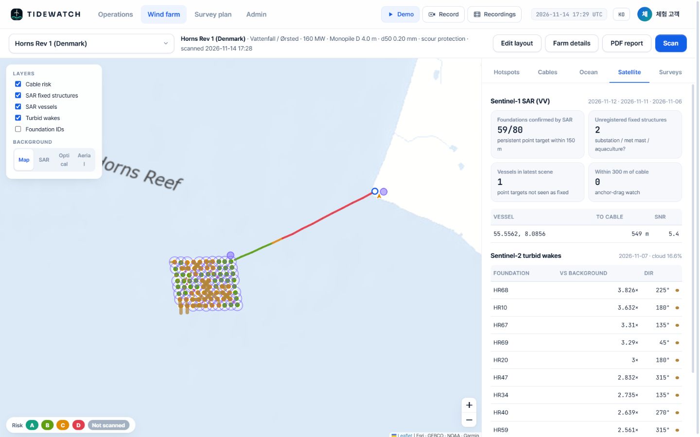
In a demo of the Southwest Sea demonstration farm in Korea, built from public information (20 jacket foundations, assumed 1.8 m members and 0.12 mm sand), 19 foundations came out at 70% of their allowance or more, the highest at 80%. It is a pilot calculation with default values, not the real condition.
With a ranking per foundation you can decide which foundations to inspect first and in more detail at the next survey. After a storm, re-scan to see how the order changed and pick the urgent targets.
A ranking does not confirm a defect. The final call is still made by the survey vessel and the ROV; TIDEWATCH sends them to the right places.
We have covered how offshore wind foundation scour forms and how to estimate and calibrate it from public ocean data; inputs and outputs are described on the foundation scour estimate page.
Frequently asked questions
Can satellites see scour?
No. Satellites cannot see below the surface. Scour is computed from ocean forcing; satellites add indirect signals such as sediment plumes behind foundations.
Does it work for jackets?
Yes, using foundation type and member diameter. Because the formulas apply differently by type, calibration with surveys matters even more.
Is it useful if we have scour protection?
Edge scour and movement of the protection still need watching. Use protection details and past surveys for calibration.
Want to know which foundations and cable segments to survey first?
Send us the farm name. We build the layout from satellite detection and return a first screening report, then calibrate it with your survey records.
Request a pilot analysis →Edited and answered by the MomentCube TIDEWATCH team / james@momentcube.com · +82-32-212-1011