Screen with satellites and ocean models. Calibrate with measurements.
TIDEWATCH works in four steps. It starts from public data alone, and as survey results build up, the next campaign gets narrower.
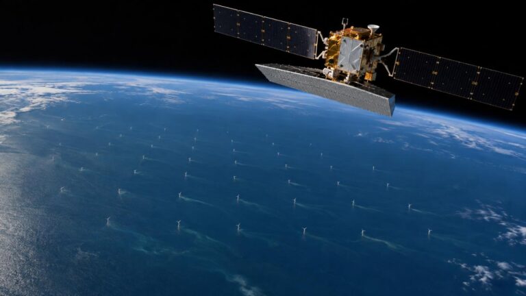
01 Register the farm
Turbine positions are detected automatically from point targets that repeat across Sentinel-1 scenes. Cable routes are estimated from the layout or imported from as-built drawings.
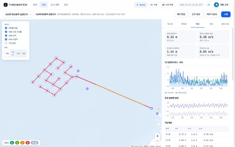
02 Compute ocean forcing
A year of hourly waves, currents and tides plus GMRT bathymetry give bed shear and equilibrium scour at every foundation and seabed mobility along every cable segment.
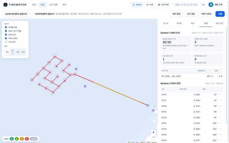
03 Add satellite evidence
Radar picks up vessels near cables; optical imagery picks up sediment plumes behind foundations. Both feed into the model risk.
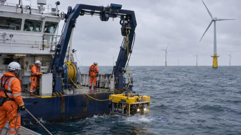
04 Survey and calibrate
Survey only the riskiest assets. Feed the results back and the model fits your site; the next campaign gets narrower.
Calibration
The more you survey, the narrower it gets.
Add the scour depth, burial depth and exposed segments confirmed by MBES and ROV, and the next computation for the same farm gets closer to site values. The next survey list shrinks.
Start
First screening from public satellite and ocean data and defaults. The farm name is enough.
Connect data
As-built coordinates, cable routes, foundation details, grain size and burial depth fit the model to your farm.
After surveys
Calibrate with the results and recompute the next survey scope and order.
Update cadence
How often it looks again
| Data | Cadence |
|---|---|
| Ocean data (waves, currents, tide, forecast) | Daily |
| Sentinel-1 radar | 6–12 days |
| Sentinel-2 optical | 5 days on clear days |
| Recompute | Any time with Scan (up to 1–2 minutes per farm) |
Satellites cannot see the seabed directly. TIDEWATCH is a screening service that flags likely risk areas first; it does not replace MBES or ROV surveys.
Related pages
Pilot analysis
Send us the wind farm name. We send back a first report.
Tell us the location, number of turbines and foundation type. We build the layout from satellite detection and return a first report with scour per foundation, exposure risk per cable segment and a survey priority list.