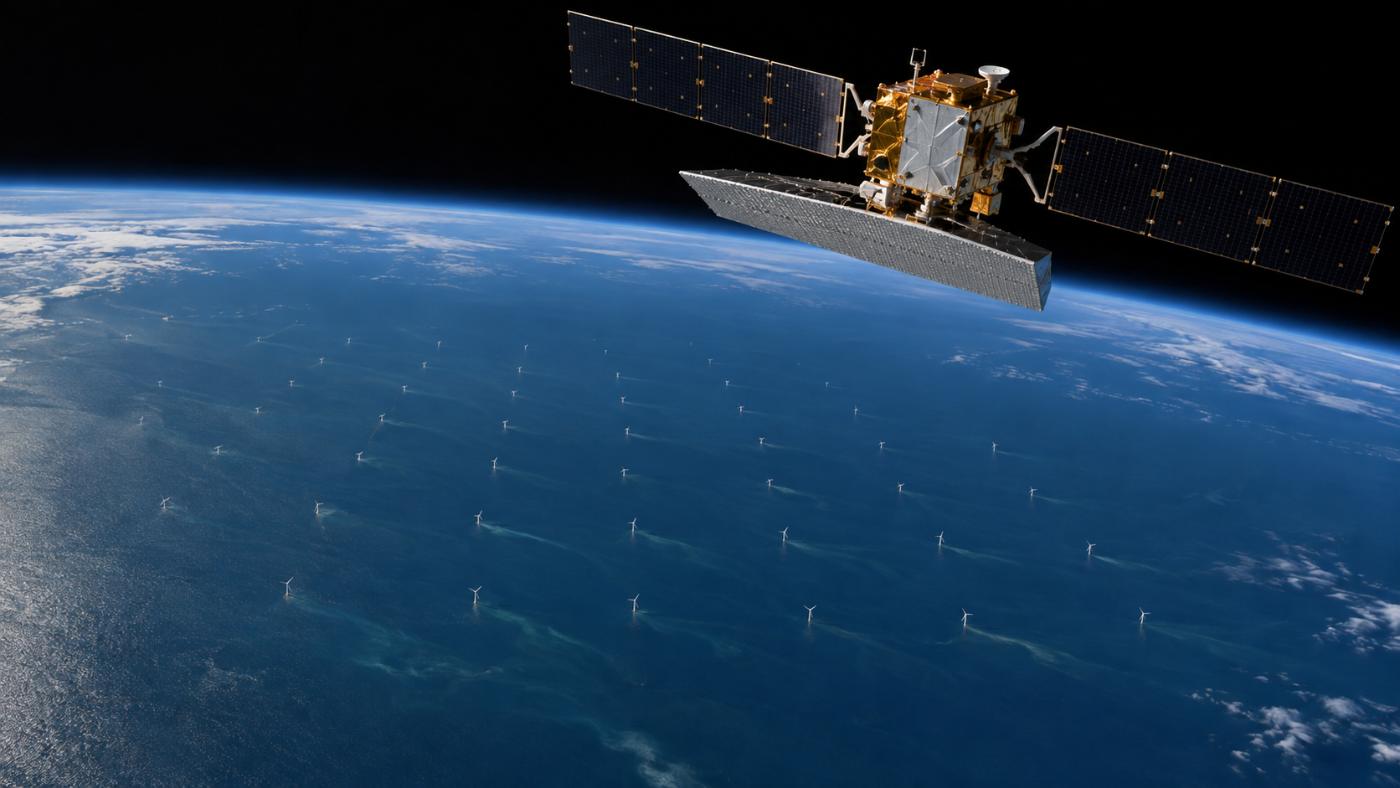
Satellites cannot see the seabed. They can see the traces.
Sentinel-1 radar separates foundations, fixed structures and vessels near cables; Sentinel-2 optical imagery catches muddy plumes downstream of foundations. TIDEWATCH adds this indirect evidence to the physics-based risk.
Radar
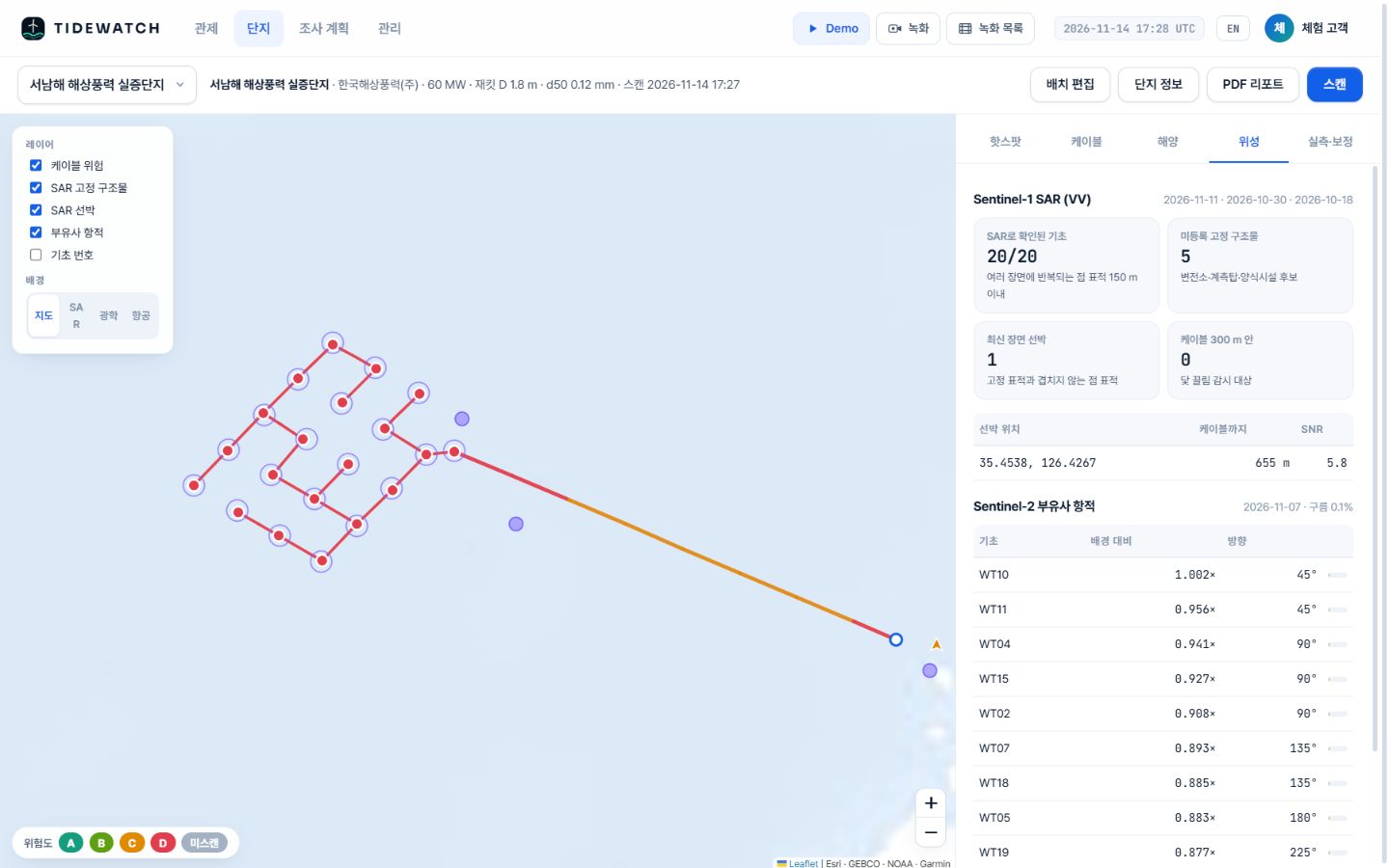
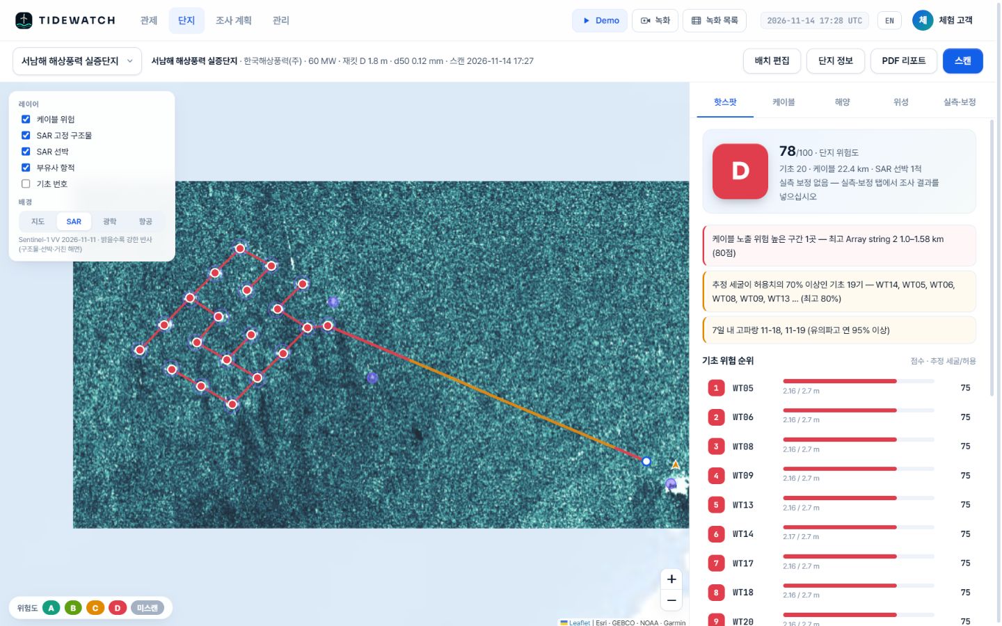
Sentinel-1 SAR (VV)
Radar sees the farm every 6–12 days regardless of cloud or darkness. The sea looks dark; steel structures and ships show up as bright points.
Foundation check
A point target that repeats across scenes within 150 m of a registered position confirms a foundation. 20 of 20 in the Southwest Sea demo.
Unregistered fixed structures
Repeating targets that are not registered are flagged as substation, met mast or aquaculture candidates.
Vessels
Targets in the latest scene that do not match fixed ones are vessels. Within 300 m of a cable they are flagged for anchor-drag watch.
Optical
Sentinel-2 sediment plumes
Every 5 days on clear days, each foundation gets a plume ratio (how much muddier than the background) and a direction. In the Tamra demo, T03 showed a plume 1.72 times the background.
Specification
Data and cadence
| Data | Use | Resolution · cadence |
|---|---|---|
| Sentinel-1 IW GRD | Structures vs. vessels, radar image | 10–20 m · 6–12 days |
| Sentinel-2 L2A | Sediment plumes, true colour | 10 m · 5 days (clear days) |
| Element84 Earth Search | Satellite scene search | — |
Is a sediment plume the same as scour?
No. A plume is an indirect sign that sand is moving around the foundation. It varies with tide and storms, so it is read together with the scour model.
How is this different from AIS?
AIS only shows vessels that broadcast. Radar also picks up vessels that do not, as point targets. Using both is better.
Related pages
Pilot analysis
Send us the wind farm name. We send back a first report.
Tell us the location, number of turbines and foundation type. We build the layout from satellite detection and return a first report with scour per foundation, exposure risk per cable segment and a survey priority list.